Old Direction Sign - Signpost by Diptford Road, Moreleigh
Introduction
The photograph on this page of Old Direction Sign - Signpost by Diptford Road, Moreleigh by Alan Rosevear as part of the Geograph project.
The Geograph project started in 2005 with the aim of publishing, organising and preserving representative images for every square kilometre of Great Britain, Ireland and the Isle of Man.

There are currently over 7.5m images from over 14,400 individuals and you can help contribute to the project by visiting https://www.geograph.org.uk
Old Direction Sign - Signpost by Diptford Road, Moreleigh
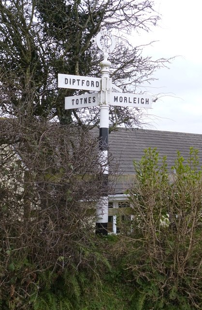
Image: © Alan Rosevear Taken: 22 Feb 2013
Annulus finial - 4 arms; Totnes RDC halo by the UC road, in parish of Halwell and Moreleigh (South Hams District), Moreleigh village, Diptford Road, in hedge. Surveyed. Milestone Society National ID: DV_SX7652
Images are licensed for reuse under creativecommons.org/licenses/by-sa/2.0
Image Location
Latitude
50.362763
Longitude
-3.736193