Old Boundary Marker by Moulden Brow, Feniscowles, Withnell Parish
Introduction
The photograph on this page of Old Boundary Marker by Moulden Brow, Feniscowles, Withnell Parish by Philip Platt as part of the Geograph project.
The Geograph project started in 2005 with the aim of publishing, organising and preserving representative images for every square kilometre of Great Britain, Ireland and the Isle of Man.

There are currently over 7.5m images from over 14,400 individuals and you can help contribute to the project by visiting https://www.geograph.org.uk
Old Boundary Marker by Moulden Brow, Feniscowles, Withnell Parish
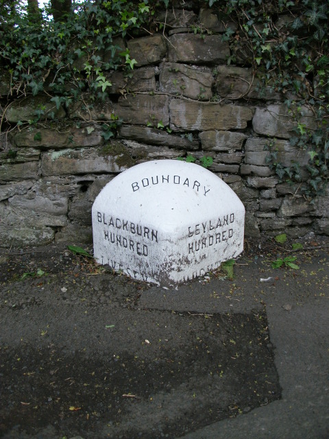
Image: © Philip Platt Taken: 15 Feb 2012
Parish Boundary Marker by the A674, in parish of Withnell (Chorley District), Moulden Brow, Feniscowles, opposite No. 27, on pavement against stone wall. On the former boundary of Hoghton and Livesey townships, both parishes from 1866. Now entirely in Withnell parish. See also https://www.geograph.org.uk/photo/7746339. Inscription reads:- : BLACKBURN / HUNDRED / LIVESEY : : BOUNDARY : : LEYLAND / HUNDRED / HOGHTON : Surveyed Milestone Society National ID: LA_HOGLIV01pb
Images are licensed for reuse under creativecommons.org/licenses/by-sa/2.0
Image Location
Latitude
53.722284
Longitude
-2.547891