Old Boundary Marker by Stoke Hill Roundabout, Exeter
Introduction
The photograph on this page of Old Boundary Marker by Stoke Hill Roundabout, Exeter by Alan Rosevear as part of the Geograph project.
The Geograph project started in 2005 with the aim of publishing, organising and preserving representative images for every square kilometre of Great Britain, Ireland and the Isle of Man.

There are currently over 7.5m images from over 14,400 individuals and you can help contribute to the project by visiting https://www.geograph.org.uk
Old Boundary Marker by Stoke Hill Roundabout, Exeter
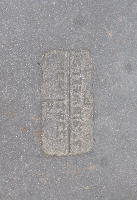
Image: © Alan Rosevear Taken: 6 Mar 2013
Parish Boundary Marker by the UC road, in parish of Exeter (Exeter District), Stoke Hill roundabout, North side, on former boundary between St Sidwell and Heavitree parishes, set in the tarmac of the pedestrian refuge on Northern approach, by Stoke Hill sign. Devon & Dartmoor HER listed. HER Number: MDV76443 https://www.heritagegateway.org.uk/Gateway/Results_Single.aspx?uid=MDV76443&resourceID=104 Surveyed Milestone Society National ID: DV_EXCMo01pb
Images are licensed for reuse under creativecommons.org/licenses/by-sa/2.0
Image Location
Latitude
50.734636
Longitude
-3.516353