Old Boundary Marker by the A308, Kingston Hill
Introduction
The photograph on this page of Old Boundary Marker by the A308, Kingston Hill by Milestone Society as part of the Geograph project.
The Geograph project started in 2005 with the aim of publishing, organising and preserving representative images for every square kilometre of Great Britain, Ireland and the Isle of Man.

There are currently over 7.5m images from over 14,400 individuals and you can help contribute to the project by visiting https://www.geograph.org.uk
Old Boundary Marker by the A308, Kingston Hill
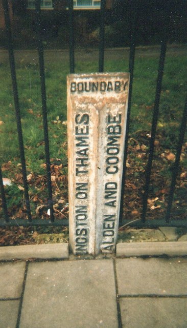
Image: © Milestone Society Taken: Unknown
Parish Boundary Marker by the A308, in parish of New Maldon (Kingston Upon Thames District), against railings on the northwest side of the A308 Kingston Hill opposite George Road. Inscription reads:- : (K)INGSTON ON THAMES : : BOUNDARY : : (M)ALDEN AND COOMBE : Surveyed Milestone Society National ID: SY_MALC03pb
Images are licensed for reuse under creativecommons.org/licenses/by-sa/2.0
Image Location
Latitude
51.419207
Longitude
-0.279051