Old Milestone by Dursley Road, Cambridge, Slimbridge
Introduction
The photograph on this page of Old Milestone by Dursley Road, Cambridge, Slimbridge by M Faherty as part of the Geograph project.
The Geograph project started in 2005 with the aim of publishing, organising and preserving representative images for every square kilometre of Great Britain, Ireland and the Isle of Man.

There are currently over 7.5m images from over 14,400 individuals and you can help contribute to the project by visiting https://www.geograph.org.uk
Old Milestone by Dursley Road, Cambridge, Slimbridge
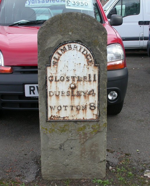
Image: © M Faherty Taken: 19 Oct 2008
Metal plate attached to stone post by the UC road (was A4135), in parish of SLIMBRIDGE (STROUD District), Dursley Road; Cambridge, just South of junction with the A38, on pavement in front car salesroom, on East side of road. Dursley plate, erected by the Berkley & Dursley (Division) turnpike trust in the 19th century. Inscription reads:- SLIMBRIDGE GLOS'TER 11 DURSLEY 4 WOTTON 8 Gloucestershire HER listed. HER Number: 49164 https://www.heritagegateway.org.uk/Gateway/Results_Single.aspx?uid=49164&resourceID=108 Milestone Society National ID: GL_WEGL08.
Images are licensed for reuse under creativecommons.org/licenses/by-sa/2.0
Image Location
Latitude
51.730854
Longitude
-2.364299