Old Guide Stone by the A628, Cliffe Kennels entrance, Penistone
Introduction
The photograph on this page of Old Guide Stone by the A628, Cliffe Kennels entrance, Penistone by Milestone Society as part of the Geograph project.
The Geograph project started in 2005 with the aim of publishing, organising and preserving representative images for every square kilometre of Great Britain, Ireland and the Isle of Man.

There are currently over 7.5m images from over 14,400 individuals and you can help contribute to the project by visiting https://www.geograph.org.uk
Old Guide Stone by the A628, Cliffe Kennels entrance, Penistone
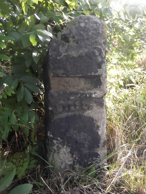
Image: © Milestone Society Taken: Unknown
Moorland Guidestoop on the A628, in parish of Penistone (Barnsley District), right-hand-side of entrance to Cliffe Kennels, about 200m East of roundabout junction with the A629. Originally, was possibly at the crossroads where the roundabout is now. Historic England Listed at GR: SE 25998 04351, which is further East again from the lane to the kennels. Out of place - in public view by public footpath/lane to kennels. Grade II listed. List Entry Number: 1315072 https://historicengland.org.uk/listing/the-list/list-entry/1315072 Milestone Society National ID: YS_XBNHSW
Images are licensed for reuse under creativecommons.org/licenses/by-sa/2.0
Image Location
Latitude
53.535146
Longitude
-1.609464