Old Milestone by the B4020, Shilton Road, Carterton
Introduction
The photograph on this page of Old Milestone by the B4020, Shilton Road, Carterton by A Rosevear as part of the Geograph project.
The Geograph project started in 2005 with the aim of publishing, organising and preserving representative images for every square kilometre of Great Britain, Ireland and the Isle of Man.

There are currently over 7.5m images from over 14,400 individuals and you can help contribute to the project by visiting https://www.geograph.org.uk
Old Milestone by the B4020, Shilton Road, Carterton
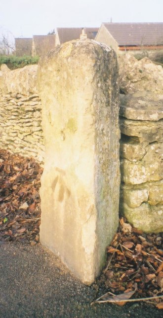
Image: © A Rosevear Taken: 1 Dec 2002
Stone post (plate lost) by the B4020, in parish of CARTERTON (WEST OXFORDSHIRE District), Shilton Road; by No.26, North of garage, between pavement and low stone wall; by drive to bungalows, on North side of road. Radcot iron plate, erected by the Faringdon & Burford turnpike trust in the 19th century. Inscription once read:- : (Burford / 3 / Faringdon / 8) : Carved benchmark at lower mid-front. Milestone Society National ID: OX_FABF08.
Images are licensed for reuse under creativecommons.org/licenses/by-sa/2.0
Image Location
Latitude
51.7691
Longitude
-1.601286