Old Milestone in Brook Lane, Roughton
Introduction
The photograph on this page of Old Milestone in Brook Lane, Roughton by A Reade as part of the Geograph project.
The Geograph project started in 2005 with the aim of publishing, organising and preserving representative images for every square kilometre of Great Britain, Ireland and the Isle of Man.

There are currently over 7.5m images from over 14,400 individuals and you can help contribute to the project by visiting https://www.geograph.org.uk
Old Milestone in Brook Lane, Roughton
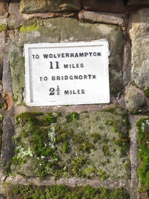
Image: © A Reade Taken: 20 Feb 2006
Metal plate attached to stone post by the UC road, in parish of WORFIELD (BRIDGNORTH District), by-road Roughton - Hoccum, Brook Lane, in garden wall, on North side of road. Black Brook plate, erected by the Bridgnorth Black Brook turnpike trust in the 19th century. Seems to have been re-located from opposite Roughton Farm House at SO 7550 9417, possibly moved in war time? Inscription reads:- : TO WOLVERHAMPTON / 11 MILES / TO BRIDGNORTH / 2½ MILES : Milestone Society National ID: SA_BNWV02.
Images are licensed for reuse under creativecommons.org/licenses/by-sa/2.0
Image Location
Latitude
52.545894
Longitude
-2.365956