Old Direction Sign - Signpost by the B2032, Waterhouse Lane, Banstead
Introduction
The photograph on this page of Old Direction Sign - Signpost by the B2032, Waterhouse Lane, Banstead by Milestone Society as part of the Geograph project.
The Geograph project started in 2005 with the aim of publishing, organising and preserving representative images for every square kilometre of Great Britain, Ireland and the Isle of Man.

There are currently over 7.5m images from over 14,400 individuals and you can help contribute to the project by visiting https://www.geograph.org.uk
Old Direction Sign - Signpost by the B2032, Waterhouse Lane, Banstead
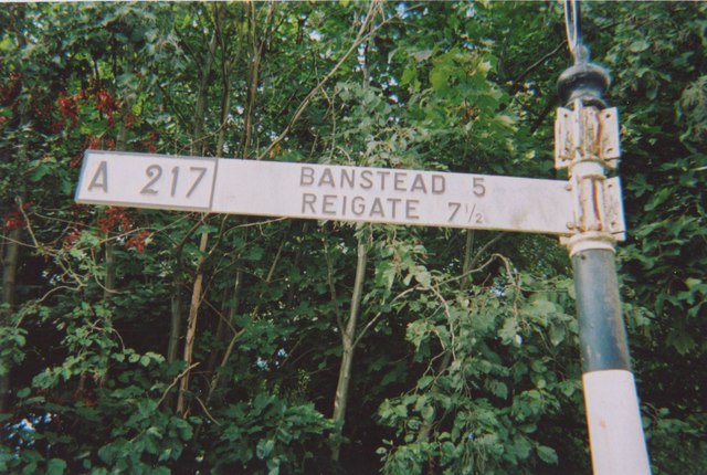
Image: © Milestone Society Taken: 22 Sep 2009
Annulus finial - 3 arms; Surrey halo by the B2032, in parish of Banstead (Reigate and Banstead District), Waterhouse Lane junction with Bonsor Drive and Morneals Road, near Kingswood Station, on verge. Surveyed Milestone Society National ID: SY_TQ2456
Images are licensed for reuse under creativecommons.org/licenses/by-sa/2.0
Image Location
Latitude
51.294765
Longitude
-0.212824