Old Milestone by the B4396, Pentrefelin
Introduction
The photograph on this page of Old Milestone by the B4396, Pentrefelin by Milestone Society as part of the Geograph project.
The Geograph project started in 2005 with the aim of publishing, organising and preserving representative images for every square kilometre of Great Britain, Ireland and the Isle of Man.

There are currently over 7.5m images from over 14,400 individuals and you can help contribute to the project by visiting https://www.geograph.org.uk
Old Milestone by the B4396, Pentrefelin
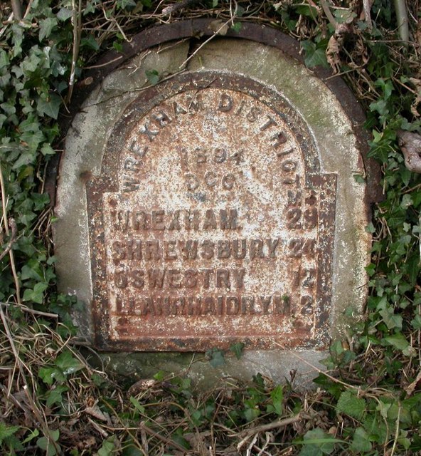
Image: © Milestone Society Taken: Unknown
Wrexham Plate by the B4396, in parish of Llanrhaeadr-ym-Mochnant (Powys District), Pentrefelin, 130m West of layby in hedgerow. Grade II listed by Cadw. List reference: 81832 https://cadwpublic-api.azurewebsites.net/reports/listedbuilding/FullReport?lang=&id=81832 Surveyed Milestone Society National ID: DEN_LRSA02
Images are licensed for reuse under creativecommons.org/licenses/by-sa/2.0
Image Location
Latitude
52.812746
Longitude
-3.256944