Old Milestone by the A68, in the parish of Rochester
Introduction
The photograph on this page of Old Milestone by the A68, in the parish of Rochester by C Minto as part of the Geograph project.
The Geograph project started in 2005 with the aim of publishing, organising and preserving representative images for every square kilometre of Great Britain, Ireland and the Isle of Man.

There are currently over 7.5m images from over 14,400 individuals and you can help contribute to the project by visiting https://www.geograph.org.uk
Old Milestone by the A68, in the parish of Rochester
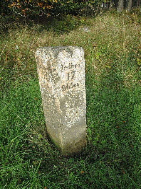
Image: © C Minto Taken: 18 Aug 2002
Carved stone post by the A68, in the parish of ROCHESTER (TYNEDALE District), 100m North West of Low Byrness, just north of junction of UC toll road, to Kielder; on the verge, grass banking, on North side of road. Newcastle quadrant stone, erected by the Elsdon & Rudwater turnpike trust in the 19th century. Inscription reads:- : Newcastle / 39 / Miles : : Jedbro / 17 / Miles : Grade II Listed. List Entry Number: 1302889 Milestone Society National ID: NB_NCJB39.
Images are licensed for reuse under creativecommons.org/licenses/by-sa/2.0
Image Location
Latitude
55.308677
Longitude
-2.351178