Old Boundary Marker by Gell Street, Sheffield
Introduction
The photograph on this page of Old Boundary Marker by Gell Street, Sheffield by Alan Rosevear as part of the Geograph project.
The Geograph project started in 2005 with the aim of publishing, organising and preserving representative images for every square kilometre of Great Britain, Ireland and the Isle of Man.

There are currently over 7.5m images from over 14,400 individuals and you can help contribute to the project by visiting https://www.geograph.org.uk
Old Boundary Marker by Gell Street, Sheffield
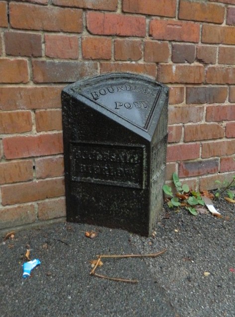
Image: © Alan Rosevear Taken: 23 Sep 2012
Parish Boundary Marker by the UC road, in parish of Sheffield (Sheffield District), on the west side of Gell Street near its junction with Conway Street, in the pavement, back to the front garden brick wall of number 94. ECCLESALL / BIERLOW and NETHER / HALLAM on adjacent faces in raised lettering. Both of these were townships in Sheffield parish until 1866, then separate parishes until 1904 when they combined with Heeley, Upper Hallam and Norton Within to create Ecclesall parish. Surveyed Milestone Society National ID: YW_ECCNHA01pb
Images are licensed for reuse under creativecommons.org/licenses/by-sa/2.0
Image Location
Latitude
53.378886
Longitude
-1.483013