Boundary Stone on Beavers Lane
Introduction
The photograph on this page of Boundary Stone on Beavers Lane by Des Blenkinsopp as part of the Geograph project.
The Geograph project started in 2005 with the aim of publishing, organising and preserving representative images for every square kilometre of Great Britain, Ireland and the Isle of Man.

There are currently over 7.5m images from over 14,400 individuals and you can help contribute to the project by visiting https://www.geograph.org.uk
Boundary Stone on Beavers Lane
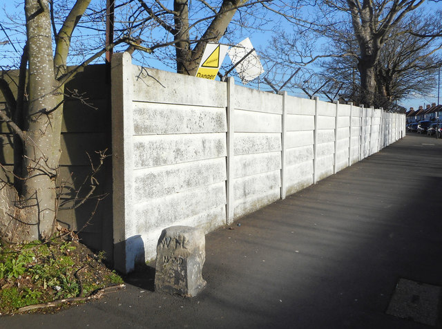
Image: © Des Blenkinsopp Taken: 28 Jan 2019
Behind the wall is Cavalry Barracks, a military site from Victorian times. This is at the south west corner and I would guess the stone marks the end of MOD land. It is inscribed WL with an arrow and N???D below, too worn away to read.
Images are licensed for reuse under creativecommons.org/licenses/by-sa/2.0
Image Location
Latitude
51.467646
Longitude
-0.394179