Stoke Lock
Introduction
The photograph on this page of Stoke Lock by David Stowell as part of the Geograph project.
The Geograph project started in 2005 with the aim of publishing, organising and preserving representative images for every square kilometre of Great Britain, Ireland and the Isle of Man.

There are currently over 7.5m images from over 14,400 individuals and you can help contribute to the project by visiting https://www.geograph.org.uk
Stoke Lock
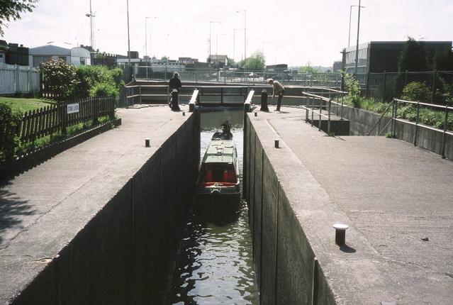
Image: © David Stowell Taken: Unknown
Other than being of concrete this lock on the Trent and Mersey Canal looks very similar to the rest of the flight. It actually dates from the early 1970s since the original lock was south of here but this replacement was built to lower the canal so the new bridge linking with the Potteries "D" road could be built.
Images are licensed for reuse under creativecommons.org/licenses/by-sa/2.0
Image Location


Leaflet Map data © OpenStreetMap
Latitude
53.009364
Longitude
-2.186254