Old Boundary Marker by the A518, Newport Road, Stafford parish
Introduction
The photograph on this page of Old Boundary Marker by the A518, Newport Road, Stafford parish by Mike Faherty as part of the Geograph project.
The Geograph project started in 2005 with the aim of publishing, organising and preserving representative images for every square kilometre of Great Britain, Ireland and the Isle of Man.

There are currently over 7.5m images from over 14,400 individuals and you can help contribute to the project by visiting https://www.geograph.org.uk
Old Boundary Marker by the A518, Newport Road, Stafford parish
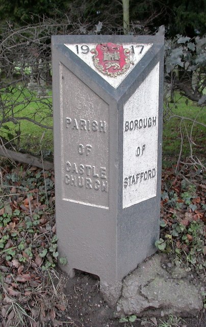
Image: © Mike Faherty Taken: 15 Jan 2011
Parish Boundary Marker by the A518, in parish of Stafford (Stafford District), Newport Road, West of parish church entrance. Surveyed Milestone Society National ID: ST_SFCC01pb
Images are licensed for reuse under creativecommons.org/licenses/by-sa/2.0
Image Location
Latitude
52.796379
Longitude
-2.14085