Old Milestone by the A86, Newtonmore Road, Kingussie and Inch Parish
Introduction
The photograph on this page of Old Milestone by the A86, Newtonmore Road, Kingussie and Inch Parish by Milestone Society as part of the Geograph project.
The Geograph project started in 2005 with the aim of publishing, organising and preserving representative images for every square kilometre of Great Britain, Ireland and the Isle of Man.

There are currently over 7.5m images from over 14,400 individuals and you can help contribute to the project by visiting https://www.geograph.org.uk
Old Milestone by the A86, Newtonmore Road, Kingussie and Inch Parish
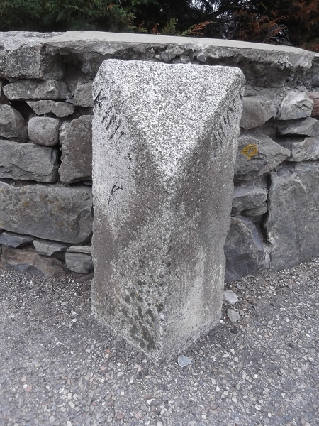
Image: © Milestone Society Taken: Unknown
Granite by the A86 (old A9), in parish of Kingussie and Inch (District), Kingussie, at junction with Tait's Brae. Inscription once read: (Kingussie ¼) / (Dalwhinnie 13¾) Milestone Society National ID: HI_IVPT44
Images are licensed for reuse under creativecommons.org/licenses/by-sa/2.0
Image Location
Latitude
57.078971
Longitude
-4.0563