Old Milestone by the A48, near Stroat House, Woolaston Parish
Introduction
The photograph on this page of Old Milestone by the A48, near Stroat House, Woolaston Parish by K Walker & R Harvey as part of the Geograph project.
The Geograph project started in 2005 with the aim of publishing, organising and preserving representative images for every square kilometre of Great Britain, Ireland and the Isle of Man.

There are currently over 7.5m images from over 14,400 individuals and you can help contribute to the project by visiting https://www.geograph.org.uk
Old Milestone by the A48, near Stroat House, Woolaston Parish
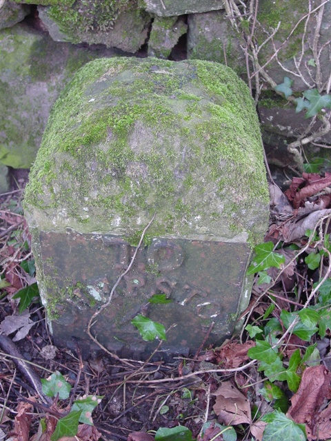
Image: © K Walker & R Harvey Taken: 17 Feb 2001
Metal plate attached to stone post by the A48, in parish of WOOLASTON (FOREST OF DEAN District), opposite Stroat Farm, on grass verge adjacent to old roadside wall, on South side of road. NC erected by the Chepstow District turnpike trust in the 19th century. Inscription reads:- TO CHEPSTOW 4 MILES Cut bench mark and rivet on top. Milestone Society National ID: GL_GLCW24.
Images are licensed for reuse under creativecommons.org/licenses/by-sa/2.0
Image Location
Latitude
51.677662
Longitude
-2.618066