Old Boundary Marker in field off Manchester Road, Clifton
Introduction
The photograph on this page of Old Boundary Marker in field off Manchester Road, Clifton by Milestone Society as part of the Geograph project.
The Geograph project started in 2005 with the aim of publishing, organising and preserving representative images for every square kilometre of Great Britain, Ireland and the Isle of Man.

There are currently over 7.5m images from over 14,400 individuals and you can help contribute to the project by visiting https://www.geograph.org.uk
Old Boundary Marker in field off Manchester Road, Clifton
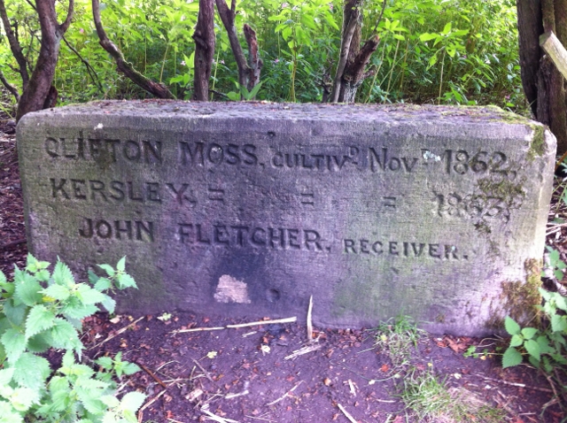
Image: © Milestone Society Taken: Unknown
Estate Boundary Marker in parish of Kearsley (Bolton District), Manchester Road, Clifton, South East corner of field, 300m South of East junction with Teak Drive. Inscription reads:- : CLIFTON MOSS CULTIVd NOVr 1862 / KERSLEY = = = 1863 / JOHN FLETCHER. RECEIVER : Surveyed Milestone Society National ID: LA_CLF01em.
Images are licensed for reuse under creativecommons.org/licenses/by-sa/2.0
Image Location
Latitude
53.528166
Longitude
-2.354327