Old Wayside Cross by the A161, Low Street, Haxey
Introduction
The photograph on this page of Old Wayside Cross by the A161, Low Street, Haxey by Alan Rosevear as part of the Geograph project.
The Geograph project started in 2005 with the aim of publishing, organising and preserving representative images for every square kilometre of Great Britain, Ireland and the Isle of Man.

There are currently over 7.5m images from over 14,400 individuals and you can help contribute to the project by visiting https://www.geograph.org.uk
Old Wayside Cross by the A161, Low Street, Haxey
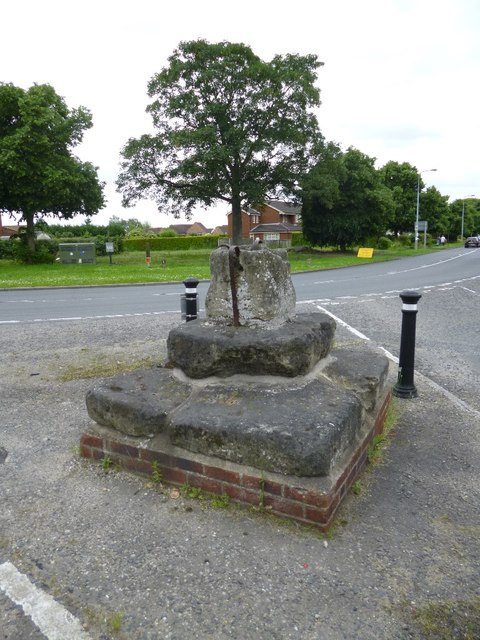
Image: © Alan Rosevear Taken: 13 Jun 2014
Haxey Cross, old shaft, base & steps, by the A161, in parish of Haxey (North Lincolnshire District), junction with Haxey Lane and High Street, on bend in the A161, by Kings PH, East of the village, on small island in middle of road at junction. Grade II listed. List Entry Number: 1083255 https://historicengland.org.uk/listing/the-list/list-entry/1083255 Scheduled Monument. List Entry Number: 1015537 https://historicengland.org.uk/listing/the-list/list-entry/1015537 Surveyed Milestone Society National ID: HMNL_HAX02
Images are licensed for reuse under creativecommons.org/licenses/by-sa/2.0
Image Location
Latitude
53.488488
Longitude
-0.8346