Old Milestone by the A377, Burrington Parish
Introduction
The photograph on this page of Old Milestone by the A377, Burrington Parish by Alan Rosevear as part of the Geograph project.
The Geograph project started in 2005 with the aim of publishing, organising and preserving representative images for every square kilometre of Great Britain, Ireland and the Isle of Man.

There are currently over 7.5m images from over 14,400 individuals and you can help contribute to the project by visiting https://www.geograph.org.uk
Old Milestone by the A377, Burrington Parish
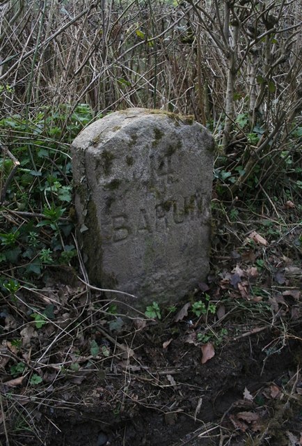
Image: © Alan Rosevear Taken: 22 Mar 2012
Carved stone post by the A377, in parish of BURRINGTON (NORTH DEVON District), 250m North West of minor road to village, 50m North of lay-by, close to road edge, on grass verge, part in hedge, on West side of road. Barum tombstone, erected by the Barnstaple turnpike trust in the 19th century. Inscription reads:- 14 BARUM Milestone Society National ID: DV_EXBS26
Images are licensed for reuse under creativecommons.org/licenses/by-sa/2.0
Image Location


Leaflet Map data © OpenStreetMap
Latitude
50.947795
Longitude
-3.925422