Old Milestone by the A631, High Street, Maltby
Introduction
The photograph on this page of Old Milestone by the A631, High Street, Maltby by C Minto as part of the Geograph project.
The Geograph project started in 2005 with the aim of publishing, organising and preserving representative images for every square kilometre of Great Britain, Ireland and the Isle of Man.

There are currently over 7.5m images from over 14,400 individuals and you can help contribute to the project by visiting https://www.geograph.org.uk
Old Milestone by the A631, High Street, Maltby
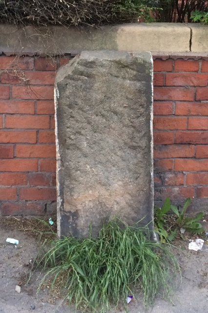
Image: © C Minto Taken: 1 Jun 1992
Metal plate attached to stone post by the A631 (Plate lost), in parish of MALTBY (ROTHERHAM District), High Street, Maltby in front of Childrens Nursery (ex Police Station), in pavement, on North side of road. Originally a Brayshaw & Booth iron casting, erected by the County Council in the 19th century. Inscription once read:- : (BAWTRY / 8 MILES / TICKHILL / 4¼ MILES) : : (BAWTRY & TINSLEY / ROAD / MALTBY) : : (SHEFFIELD / 13 MILES / TINSLEY / 9 MILES / ROTHERHAM / 6¾ MILES) : Maker:- : (BRAYSHAW & BOOTH / MAKERS / LIVERSEDGE) : Grade II listed. List Entry Number: 1151896 https://historicengland.org.uk/listing/the-list/list-entry/1151896 Milestone Society National ID: YS_TYBW09.
Images are licensed for reuse under creativecommons.org/licenses/by-sa/2.0
Image Location
Latitude
53.423466
Longitude
-1.200151