Old Milestone by the A4075, Branders Park
Introduction
The photograph on this page of Old Milestone by the A4075, Branders Park by Milestone Society as part of the Geograph project.
The Geograph project started in 2005 with the aim of publishing, organising and preserving representative images for every square kilometre of Great Britain, Ireland and the Isle of Man.

There are currently over 7.5m images from over 14,400 individuals and you can help contribute to the project by visiting https://www.geograph.org.uk
Old Milestone by the A4075, Branders Park
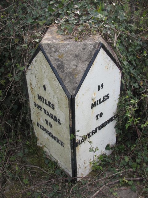
Image: © Milestone Society Taken: Unknown
Pembroke double plate by the A4075, in parish of Carew (Pembrokeshire District), Branders Park, opposite turning to Pisgah. Inscription reads:- : 4 / MILES / 922 YARDS / TO / PEMBROKE : : 14 / MILES / TO / HAVERFORDWEST : Grade II listed by Cadw. Reference Number: 18220 https://cadwpublic-api.azurewebsites.net/reports/listedbuilding/FullReport?lang=&id=18220 Surveyed Milestone Society National ID: PEM_HWPM14.
Images are licensed for reuse under creativecommons.org/licenses/by-sa/2.0
Image Location
Latitude
51.707961
Longitude
-4.816532