Old Boundary Markers by the B6107, Chain Road, south of Holt Head
Introduction
The photograph on this page of Old Boundary Markers by the B6107, Chain Road, south of Holt Head by Milestone Society as part of the Geograph project.
The Geograph project started in 2005 with the aim of publishing, organising and preserving representative images for every square kilometre of Great Britain, Ireland and the Isle of Man.

There are currently over 7.5m images from over 14,400 individuals and you can help contribute to the project by visiting https://www.geograph.org.uk
Old Boundary Markers by the B6107, Chain Road, south of Holt Head
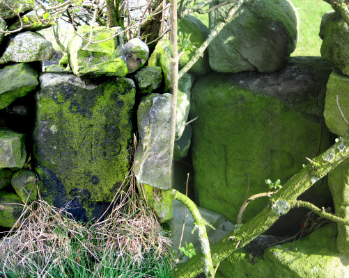
Image: © Milestone Society Taken: Unknown
Parish Boundary Markers by the B6107, in parish of Meltham (Kirklees District), Chain Road, North West side of road and opposite converted Sunday School, walled in corner of wall junction. Surveyed Milestone Society National ID: YW_MEL0pb Milestone Society National ID: YW_MEL1pb.
Images are licensed for reuse under creativecommons.org/licenses/by-sa/2.0
Image Location
Latitude
53.605607
Longitude
-1.879771