Old Direction Sign - Signpost at Conce, Luxulyan Parish
Introduction
The photograph on this page of Old Direction Sign - Signpost at Conce, Luxulyan Parish by Milestone Society as part of the Geograph project.
The Geograph project started in 2005 with the aim of publishing, organising and preserving representative images for every square kilometre of Great Britain, Ireland and the Isle of Man.

There are currently over 7.5m images from over 14,400 individuals and you can help contribute to the project by visiting https://www.geograph.org.uk
Old Direction Sign - Signpost at Conce, Luxulyan Parish
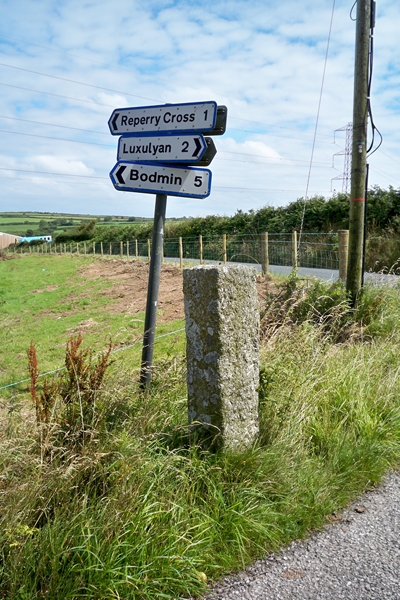
Image: © Milestone Society Taken: Unknown
No finial - top structure missing; Granite post and fingers by the UC road, in parish of Luxulyan (Restormel District), Conce Moor, opposite "Appletree Farm", T-junction (granite post only). Surveyed Milestone Society National ID: CW_SX0461.
Images are licensed for reuse under creativecommons.org/licenses/by-sa/2.0
Image Location


Leaflet Map data © OpenStreetMap
Latitude
50.422765
Longitude
-4.758473