Old Milestone by the former A379, Exminster
Introduction
The photograph on this page of Old Milestone by the former A379, Exminster by T Jenkinson as part of the Geograph project.
The Geograph project started in 2005 with the aim of publishing, organising and preserving representative images for every square kilometre of Great Britain, Ireland and the Isle of Man.

There are currently over 7.5m images from over 14,400 individuals and you can help contribute to the project by visiting https://www.geograph.org.uk
Old Milestone by the former A379, Exminster
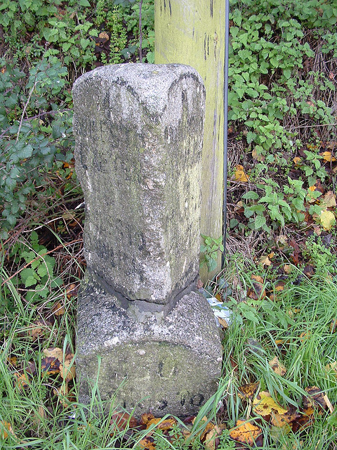
Image: © T Jenkinson Taken: 29 Nov 2006
Carved stone post by the former A379, in parish of EXMINSTER (TEIGNBRIDGE District), nearly opposite Jupes Close, 100m North of Royal Oak PH, on grass verge beside telegraph pole, on West side of road. Exeter granite facets, erected by the Exeter turnpike trust in the 19th century. Inscription reads:- : 4 / Miles to / Exeter / 8 / Miles to / Dawlish : : (180) / Miles to / (LONDON) : : 8 / Miles to / Dawlish / 4 / Miles to / Exeter : Grade II listed. List Entry Number: 1097045 https://historicengland.org.uk/listing/the-list/list-entry/1097045 Milestone Society National ID: DV_EXTG04.
Images are licensed for reuse under creativecommons.org/licenses/by-sa/2.0
Image Location
Latitude
50.675152
Longitude
-3.492116