Old Boundary Marker by Wakering Road, Southend-on-Sea
Introduction
The photograph on this page of Old Boundary Marker by Wakering Road, Southend-on-Sea by Milestone Society as part of the Geograph project.
The Geograph project started in 2005 with the aim of publishing, organising and preserving representative images for every square kilometre of Great Britain, Ireland and the Isle of Man.

There are currently over 7.5m images from over 14,400 individuals and you can help contribute to the project by visiting https://www.geograph.org.uk
Old Boundary Marker by Wakering Road, Southend-on-Sea
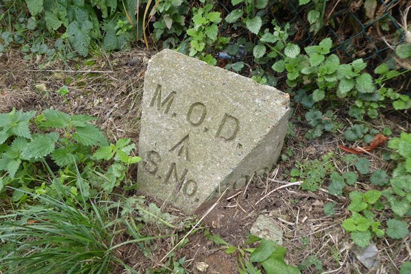
Image: © Milestone Society Taken: Unknown
Estate Boundary Marker - MOD by the UC road, in parish of Southend-on-Sea (Southend-on-Sea District), Wakering Road, next to northern gatepost at range entrance, East side of road. Surveyed. Milestone Society National ID: EX_MODSHO05em.
Images are licensed for reuse under creativecommons.org/licenses/by-sa/2.0
Image Location
Latitude
51.541157
Longitude
0.80419