Old Boundary Marker by the B5239, Worthington
Introduction
The photograph on this page of Old Boundary Marker by the B5239, Worthington by Philip Platt as part of the Geograph project.
The Geograph project started in 2005 with the aim of publishing, organising and preserving representative images for every square kilometre of Great Britain, Ireland and the Isle of Man.

There are currently over 7.5m images from over 14,400 individuals and you can help contribute to the project by visiting https://www.geograph.org.uk
Old Boundary Marker by the B5239, Worthington
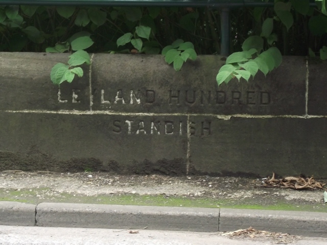
Image: © Philip Platt Taken: 14 Aug 2013
Parish Boundary Marker by the B5239, in parish of Standish (Wigan District), Worthington, 10m East of the junction with the A5106 on South West bridge parapet. Inscription reads:- : LEYLAND HUNDRED / STANDISH : Surveyed Milestone Society National ID: LA_STAHAI01pb.
Images are licensed for reuse under creativecommons.org/licenses/by-sa/2.0
Image Location
Latitude
53.583628
Longitude
-2.637391