Old Milestone, A359, Mudford Hill, North of Yeovil
Introduction
The photograph on this page of Old Milestone, A359, Mudford Hill, North of Yeovil by Mike Faherty as part of the Geograph project.
The Geograph project started in 2005 with the aim of publishing, organising and preserving representative images for every square kilometre of Great Britain, Ireland and the Isle of Man.

There are currently over 7.5m images from over 14,400 individuals and you can help contribute to the project by visiting https://www.geograph.org.uk
Old Milestone, A359, Mudford Hill, North of Yeovil
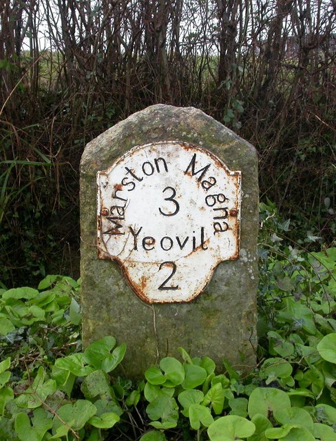
Image: © Mike Faherty Taken: 16 Jan 2008
The milestone is located south of Oaklands on the grass verge on the west side of the road. Parish of Mudford (South Somerset District). Metal plate attached to stone post, Yeovil lobe iron plate design, erected by the Yeovil turnpike trust in the 19th century. Inscription reads:- Marston Magna 3 Yeovil 2 Grade II listed. List Entry Number: 1174720 https://historicengland.org.uk/listing/the-list/list-entry/1174720 Milestone Society National ID: SO_MMYV03
Images are licensed for reuse under creativecommons.org/licenses/by-sa/2.0
Image Location
Latitude
50.962908
Longitude
-2.619822