Old Boundary Marker by the A643, Lindley Moor Road
Introduction
The photograph on this page of Old Boundary Marker by the A643, Lindley Moor Road by Milestone Society as part of the Geograph project.
The Geograph project started in 2005 with the aim of publishing, organising and preserving representative images for every square kilometre of Great Britain, Ireland and the Isle of Man.

There are currently over 7.5m images from over 14,400 individuals and you can help contribute to the project by visiting https://www.geograph.org.uk
Old Boundary Marker by the A643, Lindley Moor Road
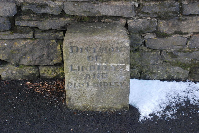
Image: © Milestone Society Taken: Unknown
Municipal Boundary Marker by the A643, in parish of Lindley (Kirklees District), Peat Ponds Farm, Lindley Moor Road, against the farmhouse wall. N.B. The area has been developed for industrial use since 2016, but on Streetview 2019 the stone appears to have been preserved. Inscription reads:- DIVISION OF LINDLEY AND OLD LINDLEY Grade II listed. List Entry Number: 1134956 https://historicengland.org.uk/listing/the-list/list-entry/1134956 Surveyed Milestone Society National ID: YW_LIND01pb.
Images are licensed for reuse under creativecommons.org/licenses/by-sa/2.0
Image Location
Latitude
53.665669
Longitude
-1.843021