Footpath from Aldi alongside Black Lynn
Introduction
The photograph on this page of Footpath from Aldi alongside Black Lynn by Iain Macdonald as part of the Geograph project.
The Geograph project started in 2005 with the aim of publishing, organising and preserving representative images for every square kilometre of Great Britain, Ireland and the Isle of Man.

There are currently over 7.5m images from over 14,400 individuals and you can help contribute to the project by visiting https://www.geograph.org.uk
Footpath from Aldi alongside Black Lynn
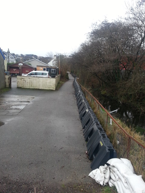
Image: © Iain Macdonald Taken: 29 Jan 2019
Photographed from the roadside at the start of the footpath, looking uphill. This short section of path alongside the Black Lynn, a small burn seen on the right, offers a pleasant alternative to Soroba Road for pedestrians. The associated section of Soroba Road lacks a pavement for much of the length of this path, which runs approximately parallel. Note the sandbags and plastic flood defences, as well as the tarmac banked defences visible beyond the end of the plastic ones; these are a recent addition following severe flooding in 2018 which made national news. The path is lined with trees and poorly lit, making it less attractive in hours of darkness. The inevitable Tesco shopping trolley, upended in the water, can be seen peeking out.
Images are licensed for reuse under creativecommons.org/licenses/by-sa/2.0
Image Location
Latitude
56.40704
Longitude
-5.469948