
Stratton Strawless Hall and Radar block
Introduction
The photograph on this page of Stratton Strawless Hall and Radar block by Adrian S Pye as part of the Geograph project.
The Geograph project started in 2005 with the aim of publishing, organising and preserving representative images for every square kilometre of Great Britain, Ireland and the Isle of Man.

There are currently over 7.5m images from over 14,400 individuals and you can help contribute to the project by visiting https://www.geograph.org.uk
Stratton Strawless Hall and Radar block
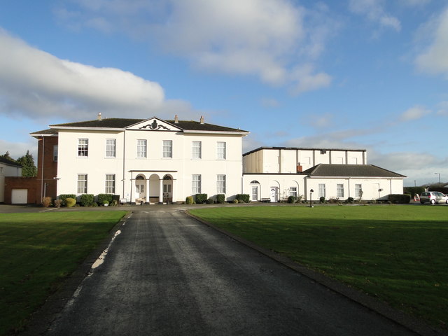
Image: © Adrian S Pye Taken: 28 Jan 2019
The Hall dates to around 1800 and replaces a previous hall which burned down. It has two storeys and six bays with the centre two projecting slightly under a pediment bearing a coat of arms. The entrance takes the form of a triple archway with two Tuscan columns giving onto a recessed entrance with two doors with fanlights. The house is now divided into flats. To the right is a tall block added by the RAF as a Radar Control HQ in about 1940.
Images are licensed for reuse under creativecommons.org/licenses/by-sa/2.0
Image Location

Latitude
52.730483
Longitude
1.27464