Old Milepost by the A306, Rocks Lane, Barnes
Introduction
The photograph on this page of Old Milepost by the A306, Rocks Lane, Barnes by C Woodward as part of the Geograph project.
The Geograph project started in 2005 with the aim of publishing, organising and preserving representative images for every square kilometre of Great Britain, Ireland and the Isle of Man.

There are currently over 7.5m images from over 14,400 individuals and you can help contribute to the project by visiting https://www.geograph.org.uk
Old Milepost by the A306, Rocks Lane, Barnes
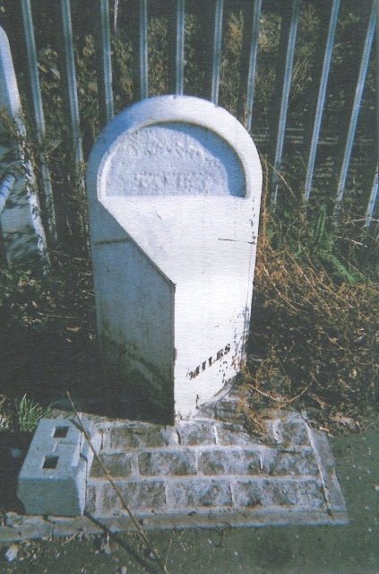
Image: © C Woodward Taken: 26 Mar 2012
Cast iron post by the A306, in parish of BARNES (RICHMOND UPON THAMES District), Rocks Lane SW13, at South end of railway bridge embankment, on verge behind footpath, back to railings; set in paviors, on East side of road. Middlesex iron casting, erected by an unknown authority in the 19th century. Inscription reads:- : KINGSTON / 5½ / MILES : : (PARISH OF) BARNES : : (HYDE PARK / CORNER / 5½ MILES / RICHMOND / 2½) MILES : Milestone Society National ID: SY_LKG05A.
Images are licensed for reuse under creativecommons.org/licenses/by-sa/2.0
Image Location


Leaflet Map data © OpenStreetMap
Latitude
51.465786
Longitude
-0.243136