Old Milestone by Victoria Road, Mount Charles, St Austell
Introduction
The photograph on this page of Old Milestone by Victoria Road, Mount Charles, St Austell by Ian Thompson as part of the Geograph project.
The Geograph project started in 2005 with the aim of publishing, organising and preserving representative images for every square kilometre of Great Britain, Ireland and the Isle of Man.

There are currently over 7.5m images from over 14,400 individuals and you can help contribute to the project by visiting https://www.geograph.org.uk
Old Milestone by Victoria Road, Mount Charles, St Austell
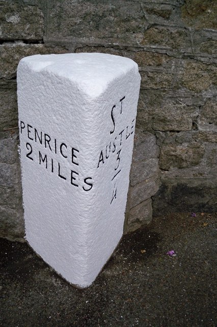
Image: © Ian Thompson Taken: Unknown
Carved stone post by the UC road, in parish of ST AUSTELL (RESTORMEL District), Victoria Road, by No.11, Mount Charles, half buried in pavement until 1992, on North side of road. Erected by a private estate in the 19th century. Inscription reads:- : PENRICE / 2 MILES : : ST / AUSTLE / 3/4 : Grade II listed. List Entry Number: 1394421 https://historicengland.org.uk/listing/the-list/list-entry/1394421 Milestone Society National ID: CW_PCSA02.
Images are licensed for reuse under creativecommons.org/licenses/by-sa/2.0
Image Location
Latitude
50.338358
Longitude
-4.776838