Old Bridge Marker by Carr Head Lane, Glusburn
Introduction
The photograph on this page of Old Bridge Marker by Carr Head Lane, Glusburn by Milestone Society as part of the Geograph project.
The Geograph project started in 2005 with the aim of publishing, organising and preserving representative images for every square kilometre of Great Britain, Ireland and the Isle of Man.

There are currently over 7.5m images from over 14,400 individuals and you can help contribute to the project by visiting https://www.geograph.org.uk
Old Bridge Marker by Carr Head Lane, Glusburn
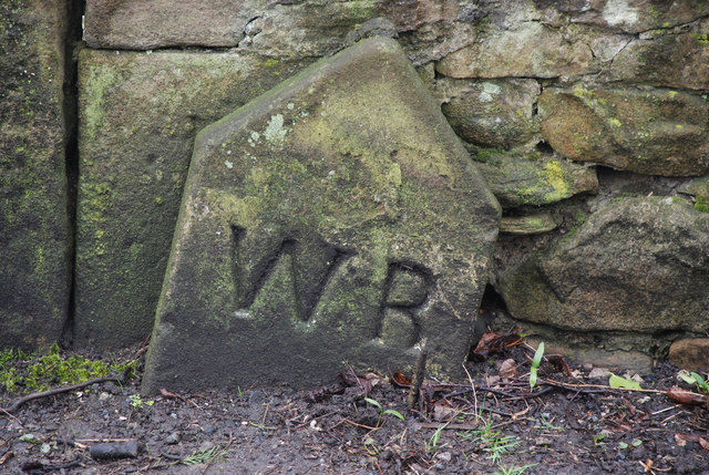
Image: © Milestone Society Taken: Unknown
Bridge Marker by the UC road, in parish of Glusburn and Cross Hills (Craven District), Carr Head Lane, Glusburn, approach to Lumb Mill Bridge, beside road, against wall of Malsis School. Surveyed Milestone Society National ID: YW_GLUS02br.
Images are licensed for reuse under creativecommons.org/licenses/by-sa/2.0
Image Location


Leaflet Map data © OpenStreetMap
Latitude
53.896401
Longitude
-2.018833