Old Milepost by the A697, High Learchild
Introduction
The photograph on this page of Old Milepost by the A697, High Learchild by CMinto & IA Davison as part of the Geograph project.
The Geograph project started in 2005 with the aim of publishing, organising and preserving representative images for every square kilometre of Great Britain, Ireland and the Isle of Man.

There are currently over 7.5m images from over 14,400 individuals and you can help contribute to the project by visiting https://www.geograph.org.uk
Old Milepost by the A697, High Learchild
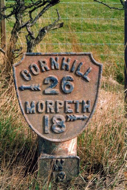
Image: © CMinto & IA Davison Taken: 15 Aug 2002
Metal post with attached metal plate by the A697, in parish of EDLINGHAM (ALNWICK District), between Learchild Moor House and High Learchild, North of B6341 crossroads, on narrow verge, on East side of road. Smith Patterson iron shield, erected by the Morpeth to River Beamish turnpike trust in the 19th century. Inscription reads:- CORNHILL {arrow to left} 26 MORPETH 18 {arrow to right} (On plate attached to post) W 13 Maker:- : SMITH PATTERSON / & CO / BLAYDON : Grade II listed. List Entry Number: 1372249 https://historicengland.org.uk/listing/the-list/list-entry/1372249 Milestone Society National ID: NB_MPCH18.
Images are licensed for reuse under creativecommons.org/licenses/by-sa/2.0
Image Location
Latitude
55.386263
Longitude
-1.853021