Old Direction Sign - Signpost by the A394, Kenneggy Downs
Introduction
The photograph on this page of Old Direction Sign - Signpost by the A394, Kenneggy Downs by Milestone Society as part of the Geograph project.
The Geograph project started in 2005 with the aim of publishing, organising and preserving representative images for every square kilometre of Great Britain, Ireland and the Isle of Man.

There are currently over 7.5m images from over 14,400 individuals and you can help contribute to the project by visiting https://www.geograph.org.uk
Old Direction Sign - Signpost by the A394, Kenneggy Downs
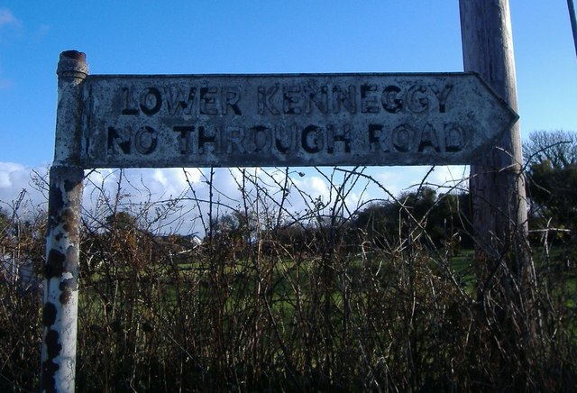
Image: © Milestone Society Taken: Unknown
No finial - 1 arm; by the A394, in parish of Breage (Kerrier District), Lower Kenneggy turn, in hedge. Damaged Jun 2011 on Streetview, so possibly lost, or buried in hedge. To be surveyed Milestone Society National ID: CW_SW5729.
Images are licensed for reuse under creativecommons.org/licenses/by-sa/2.0
Image Location
Latitude
50.112592
Longitude
-5.40022