Old Direction Sign - Signpost by the A262, Sissinghurst
Introduction
The photograph on this page of Old Direction Sign - Signpost by the A262, Sissinghurst by Milestone Society as part of the Geograph project.
The Geograph project started in 2005 with the aim of publishing, organising and preserving representative images for every square kilometre of Great Britain, Ireland and the Isle of Man.

There are currently over 7.5m images from over 14,400 individuals and you can help contribute to the project by visiting https://www.geograph.org.uk
Old Direction Sign - Signpost by the A262, Sissinghurst
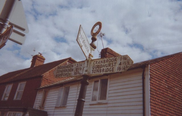
Image: © Milestone Society Taken: Unknown
Annulus finial - 3 arms; Kent CC parish halo by the A262, in parish of Cranbrook (Tunbridge Wells District), The Street, opposite Common Road, Sissinghurst, behind wall and hedge of garden. Surveyed Milestone Society National ID: KE_TQ7937.
Images are licensed for reuse under creativecommons.org/licenses/by-sa/2.0
Image Location


Leaflet Map data © OpenStreetMap
Latitude
51.108837
Longitude
0.560104