Old Boundary Marker by the A40, Oxford Road, Denham Parish
Introduction
The photograph on this page of Old Boundary Marker by the A40, Oxford Road, Denham Parish by Milestone Society as part of the Geograph project.
The Geograph project started in 2005 with the aim of publishing, organising and preserving representative images for every square kilometre of Great Britain, Ireland and the Isle of Man.

There are currently over 7.5m images from over 14,400 individuals and you can help contribute to the project by visiting https://www.geograph.org.uk
Old Boundary Marker by the A40, Oxford Road, Denham Parish
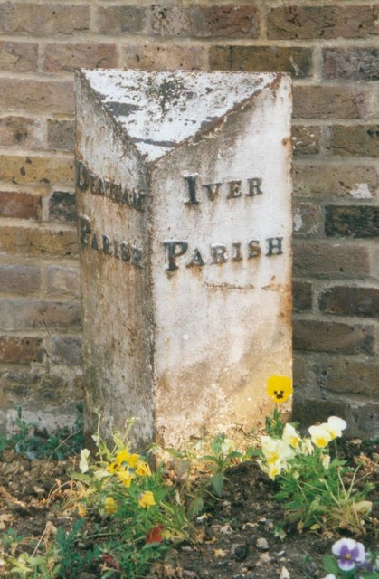
Image: © Milestone Society Taken: Unknown
Parish Boundary Marker by the A40, in parish of Denham (South Bucks District), Oxford Road; just west of where road crosses M25 on a bridge; outside Pinstone Cottage, west of Tatling End, in flower bed in front of garden wall; to right of gate. Inscription reads:- : DENHAM / PARISH : : IVER / PARISH : Surveyed Milestone Society National ID: BU_LW18pb.
Images are licensed for reuse under creativecommons.org/licenses/by-sa/2.0
Image Location
Latitude
51.574863
Longitude
-0.537484