19th Century turnpike milestone - Goginan
Introduction
The photograph on this page of 19th Century turnpike milestone - Goginan by Richard Law as part of the Geograph project.
The Geograph project started in 2005 with the aim of publishing, organising and preserving representative images for every square kilometre of Great Britain, Ireland and the Isle of Man.

There are currently over 7.5m images from over 14,400 individuals and you can help contribute to the project by visiting https://www.geograph.org.uk
19th Century turnpike milestone - Goginan
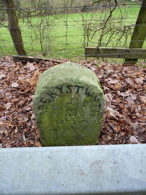
Image: © Richard Law Taken: 25 Dec 2018
Grade II listed https://britishlistedbuildings.co.uk/300082810-milestone-sw-of-goginan-melindwr#.XExxzlz7TIU in 2004, the milestone stands immediately behind the modern 'Armco' barrier, and presumably dates from the turnpiking of the road in 1812. This is one of a series along the A44.
Images are licensed for reuse under creativecommons.org/licenses/by-sa/2.0
Image Location
Latitude
52.410646
Longitude
-3.933098