Oxford Road
Introduction
The photograph on this page of Oxford Road by Gerald England as part of the Geograph project.
The Geograph project started in 2005 with the aim of publishing, organising and preserving representative images for every square kilometre of Great Britain, Ireland and the Isle of Man.

There are currently over 7.5m images from over 14,400 individuals and you can help contribute to the project by visiting https://www.geograph.org.uk
Oxford Road
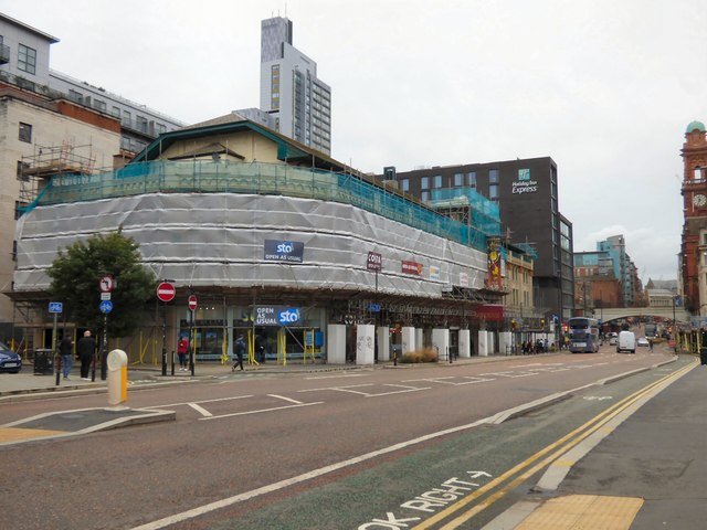
Image: © Gerald England Taken: 22 Sep 2018
Currently covered by scaffolding is the Grade II listed https://historicengland.org.uk/listing/the-list/list-entry/1384997 Dancehouse Theatre http://manchesterhistory.net/manchester/tours/tour8/area8page5.html Originally it housed two cinemas called The Regal Twins. In the 1960s it was converted into a five screen complex before closing in 1986. The lease of the abandoned property was obtained by the Northern Ballet School in 1990. In collaboration with The Dancehouse Theatre they restored the building to its former Art Deco splendour. One cinema was converted into the Dancehouse Theatre and the other 4 cinemas became dance studios. The refurbished building was re-opened by HRH Princess Margaret in 1994.
Images are licensed for reuse under creativecommons.org/licenses/by-sa/2.0
Image Location
Latitude
53.472731
Longitude
-2.239804