Taringzean Castle Site
Introduction
The photograph on this page of Taringzean Castle Site by Mary and Angus Hogg as part of the Geograph project.
The Geograph project started in 2005 with the aim of publishing, organising and preserving representative images for every square kilometre of Great Britain, Ireland and the Isle of Man.

There are currently over 7.5m images from over 14,400 individuals and you can help contribute to the project by visiting https://www.geograph.org.uk
Taringzean Castle Site
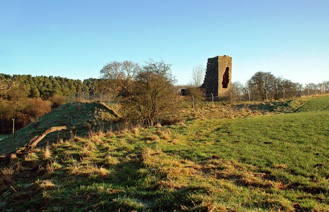
Image: © Mary and Angus Hogg Taken: 17 Jan 2019
Taringzen, or Terringzean, Castle is located on high ground to the south of the Lugar Water and is protected on the south-west side by a dry ditch. The first buildings, including the tower, may date from the late 14th century. Additions were made towards the end of the 16th century. There’s not a lot left to see nowadays.
Images are licensed for reuse under creativecommons.org/licenses/by-sa/2.0
Image Location
Latitude
55.45697
Longitude
-4.285719