Weighton Lock
Introduction
The photograph on this page of Weighton Lock by Graham Hogg as part of the Geograph project.
The Geograph project started in 2005 with the aim of publishing, organising and preserving representative images for every square kilometre of Great Britain, Ireland and the Isle of Man.

There are currently over 7.5m images from over 14,400 individuals and you can help contribute to the project by visiting https://www.geograph.org.uk
Weighton Lock
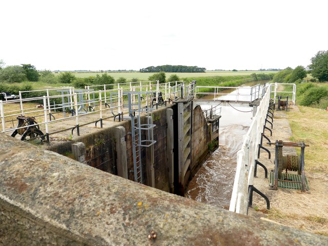
Image: © Graham Hogg Taken: 26 Jun 2017
A bi-directional (tidal) lock linking the Market Weighton Canal to the Humber Estuary. Built in 1773, repaired in 1826 and restored in 1994 it is maintained by the Environment Agency to maintain suitable water levels in the canal. It is rarely used by powered craft (apparently the cost is prohibitive).
Images are licensed for reuse under creativecommons.org/licenses/by-sa/2.0
Image Location
Latitude
53.719946
Longitude
-0.67671