Stow
Introduction
The photograph on this page of Stow by Richard Webb as part of the Geograph project.
The Geograph project started in 2005 with the aim of publishing, organising and preserving representative images for every square kilometre of Great Britain, Ireland and the Isle of Man.

There are currently over 7.5m images from over 14,400 individuals and you can help contribute to the project by visiting https://www.geograph.org.uk
Stow
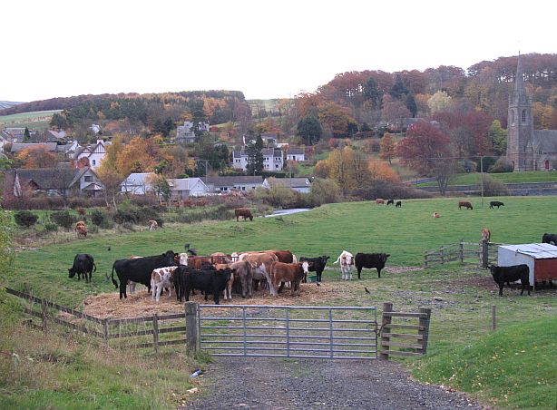
Image: © Richard Webb Taken: 2 Nov 2007
A major influence on this fast growing village is the Gala Water. Behind the camera are several new houses, with more to come. The old town centre can be seen opposite, beside the churches (the old ruined one is not visible). Between the two parts, cattle still graze on flood prone land. Note the raised bank alongside the river.
Images are licensed for reuse under creativecommons.org/licenses/by-sa/2.0
Image Location
Latitude
55.691368
Longitude
-2.864685