Benchmark on Delf Hill triangulation pillar
Introduction
The photograph on this page of Benchmark on Delf Hill triangulation pillar by Roger Templeman as part of the Geograph project.
The Geograph project started in 2005 with the aim of publishing, organising and preserving representative images for every square kilometre of Great Britain, Ireland and the Isle of Man.

There are currently over 7.5m images from over 14,400 individuals and you can help contribute to the project by visiting https://www.geograph.org.uk
Benchmark on Delf Hill triangulation pillar
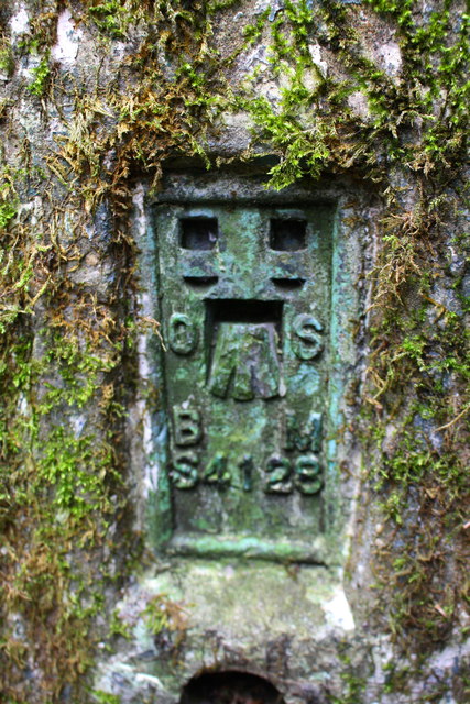
Image: © Roger Templeman Taken: 23 Aug 2018
Ordnance Survey flush bracket (serial identifier S4128) benchmark described on the OS Database as: SE14812799 FLUSH BRACKET FL BR S4128 DELF HILL TP (GPS HEIGHTED 1989 218.37M) Levelled 1962 at ODN 218.442m
Images are licensed for reuse under creativecommons.org/licenses/by-sa/2.0
Image Location
Latitude
53.748075
Longitude
-1.776903