Pont Deunant
Introduction
The photograph on this page of Pont Deunant by Eirian Evans as part of the Geograph project.
The Geograph project started in 2005 with the aim of publishing, organising and preserving representative images for every square kilometre of Great Britain, Ireland and the Isle of Man.

There are currently over 7.5m images from over 14,400 individuals and you can help contribute to the project by visiting https://www.geograph.org.uk
Pont Deunant
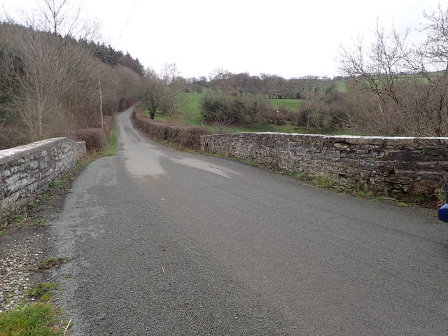
Image: © Eirian Evans Taken: 3 Jan 2019
Road bridge on a minor country road, spanning the Afon Deunant, halfway betweenof Bryn Rhydarian and Llansannan. It was built in 1785, the bond of November 1784 specifying that the bridge be built by 24th June of the following year. The contract was awarded to David Lewis, mason, and the bridge was constructed from stone quarried from the Nantglyn Quarry. It is Grade II listed.
Images are licensed for reuse under creativecommons.org/licenses/by-sa/2.0
Image Location
Latitude
53.174
Longitude
-3.556066