Railway Lines near Farringdon Station
Introduction
The photograph on this page of Railway Lines near Farringdon Station by Danny P Robinson as part of the Geograph project.
The Geograph project started in 2005 with the aim of publishing, organising and preserving representative images for every square kilometre of Great Britain, Ireland and the Isle of Man.

There are currently over 7.5m images from over 14,400 individuals and you can help contribute to the project by visiting https://www.geograph.org.uk
Railway Lines near Farringdon Station
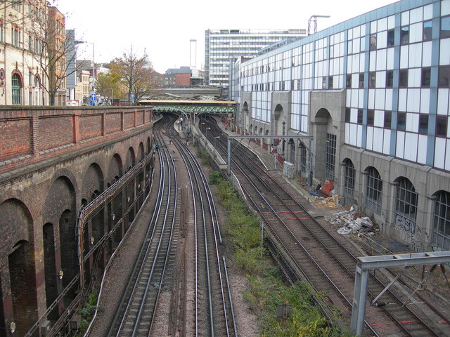
Image: © Danny P Robinson Taken: 1 Nov 2007
Picture taken from Clerkenwell Road. Farringdon Station can be seen about 200 metres away. Note the different types of railway track -- to the left, the London Underground ones with a live rail, to the right, the Capital Connect (once known as Thameslink) lines with the overhead power supply. At street level, Turnmill Street is to the left and on the right is the rear view of offices on Farringdon Road.
Images are licensed for reuse under creativecommons.org/licenses/by-sa/2.0
Image Location
Latitude
51.52164
Longitude
-0.10745