Brixton: The Windmill
Introduction
The photograph on this page of Brixton: The Windmill by Nigel Cox as part of the Geograph project.
The Geograph project started in 2005 with the aim of publishing, organising and preserving representative images for every square kilometre of Great Britain, Ireland and the Isle of Man.

There are currently over 7.5m images from over 14,400 individuals and you can help contribute to the project by visiting https://www.geograph.org.uk
Brixton: The Windmill
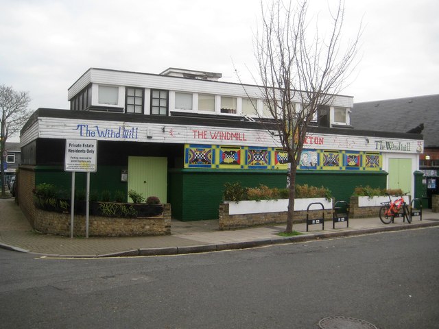
Image: © Nigel Cox Taken: 14 Dec 2018
No, not the actual Windmill, but the eponymous public house in Blenheim Gardens. Old Ordnance Survey maps show that the present day Blenheim Gardens was once a thoroughfare known as Cornwall Road that linked Brixton Hill and Lyham Road, and that there was a public house called The Windmill on the corner of Blenheim Gardens and Bartley Road. Bartley Road and the earlier pub have long since gone, following the regeneration of the area in the 1960s and 1970s, and this newer building dates from then. The black dog on the roof far right is genuine, believe me!
Images are licensed for reuse under creativecommons.org/licenses/by-sa/2.0
Image Location
Latitude
51.453991
Longitude
-0.122627