Crown House, St Mary's Street, Shrewsbury
Introduction
The photograph on this page of Crown House, St Mary's Street, Shrewsbury by Stephen Richards as part of the Geograph project.
The Geograph project started in 2005 with the aim of publishing, organising and preserving representative images for every square kilometre of Great Britain, Ireland and the Isle of Man.

There are currently over 7.5m images from over 14,400 individuals and you can help contribute to the project by visiting https://www.geograph.org.uk
Crown House, St Mary's Street, Shrewsbury
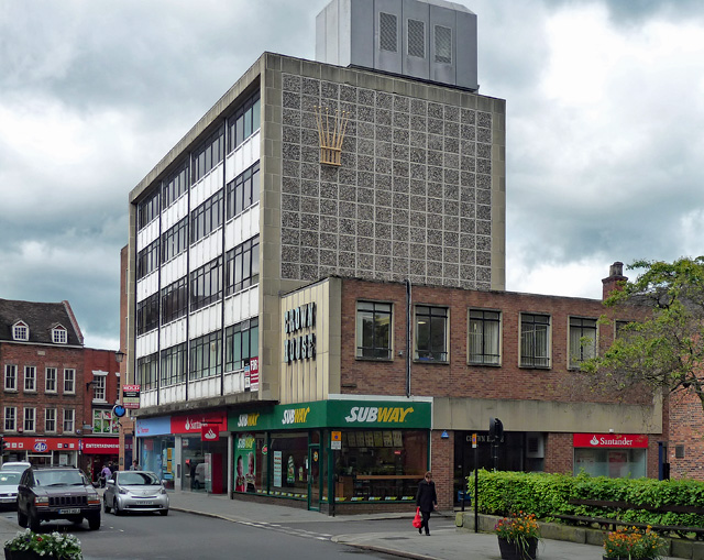
Image: © Stephen Richards Taken: 12 May 2014
One of the town centre's relatively few 1960s buildings. Note the stylised crown on the end wall. Shops and offices - possibly converted to flats since this photo.
Images are licensed for reuse under creativecommons.org/licenses/by-sa/2.0
Image Location
Latitude
52.708855
Longitude
-2.752151