Bench mark in Pantymwyn, Flintshire
Introduction
The photograph on this page of Bench mark in Pantymwyn, Flintshire by John S Turner as part of the Geograph project.
The Geograph project started in 2005 with the aim of publishing, organising and preserving representative images for every square kilometre of Great Britain, Ireland and the Isle of Man.

There are currently over 7.5m images from over 14,400 individuals and you can help contribute to the project by visiting https://www.geograph.org.uk
Bench mark in Pantymwyn, Flintshire
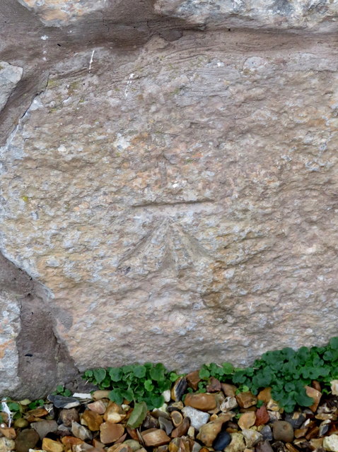
Image: © John S Turner Taken: 4 Dec 2018
This Ordnance Survey bench mark is cut into the roadside face of a modernised old stone building on the corner of Cilcain Road and Pen y Fron Road - Image The mark was last recorded on the 1878 O.S. map.
Images are licensed for reuse under creativecommons.org/licenses/by-sa/2.0
Image Location
Latitude
53.172609
Longitude
-3.202778