Glasgow from the air
Introduction
The photograph on this page of Glasgow from the air by Thomas Nugent as part of the Geograph project.
The Geograph project started in 2005 with the aim of publishing, organising and preserving representative images for every square kilometre of Great Britain, Ireland and the Isle of Man.

There are currently over 7.5m images from over 14,400 individuals and you can help contribute to the project by visiting https://www.geograph.org.uk
Glasgow from the air
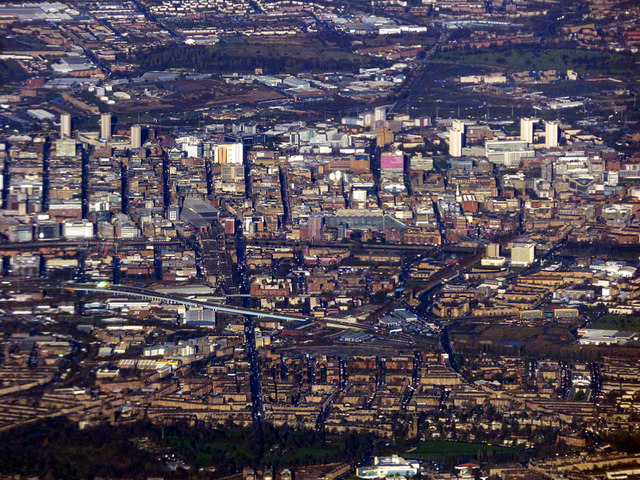
Image: © Thomas Nugent Taken: 3 Dec 2018
The Victoria Infirmary and Queens Park can be seen in the foreground, with Victoria Road heading north to the city centre where the two largest glass roofs in the world can be seen at Glasgow Central railway station and St Enoch Shopping Centre. The elevated M74 northern extension can be seen in the left foreground. In the left distance, the developments around the former distillery at Port Dundas are visible as are the developments at the site of the Sighthill towerblocks in the right distance. The recently electrified Glasgow to Edinburgh railway line can be seen near the top centre. Viewed from a Prague bound flight just north of Darvel, which is around 15 miles from the city centre.
Images are licensed for reuse under creativecommons.org/licenses/by-sa/2.0
Image Location
Latitude
55.825938
Longitude
-4.260377